

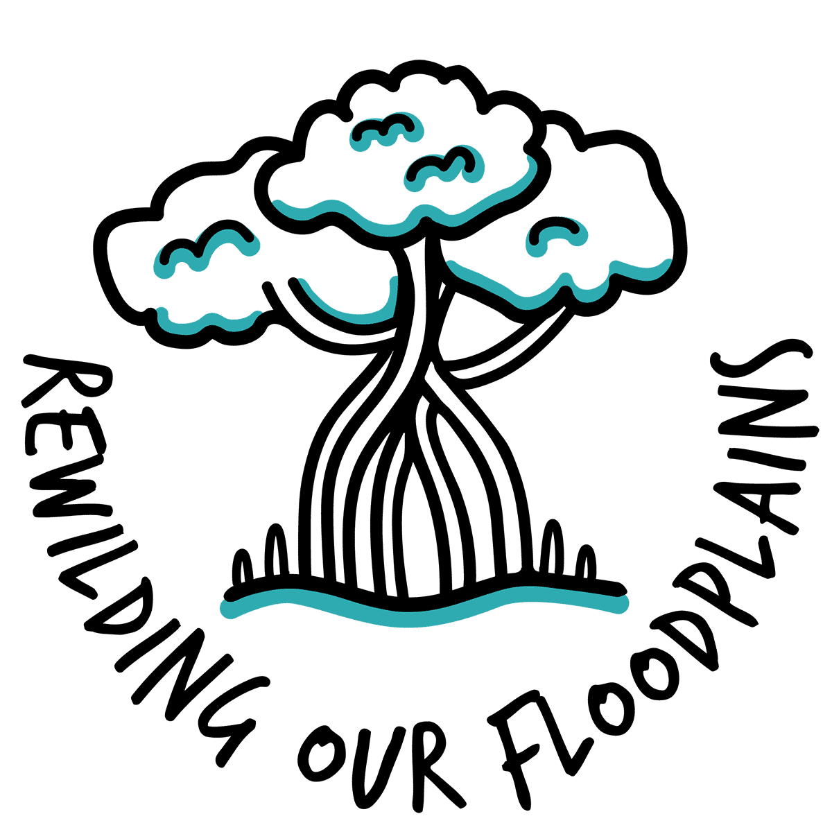
Ecological Mapping + Monitoring + Evaluation + Community Engagement + Pollution Solutions + On-Ground Rewilding = Healthy Catchments + Climate Resilience!


Rivers Connect Us All
While river systems cover less than 1% of the earth’s surface, they provide habitat and breeding grounds for over 40% of the earth’s species. Many people are unaware that they are the most biodiverse ecosystems on earth!
Rivers are the beating heart of the ocean, connecting mountains to floodplains, to the sea. Yet, despite the vital social, cultural, environmental and economic value that they provide, our catchments are suffering from a range of negative impacts from over-development, poor land management, waste & pollution, invasive species and poorly regulated water use, with studies reflecting that over half of the earth’s river systems have been severely affected by human activities. Left unchecked, these cumulative impacts are irreversibly damaging incredibly complex ecological systems, along with our climate and our way of life.
Our Rewilding our Floodplains program takes an integrated, ecosystem approach to determine waterway health based on key environmental factors. We work with the community to develop solutions that will create real change and long-lasting rejuvenation of our catchments and the ocean, exploring multi-stakeholder strategic corridors that create a bridge across catchments, from source to sea, while providing long-term climate resilience.
HELP FUND ROF NSW BECOME A CORPORATE PARTNER FOR ROF NSW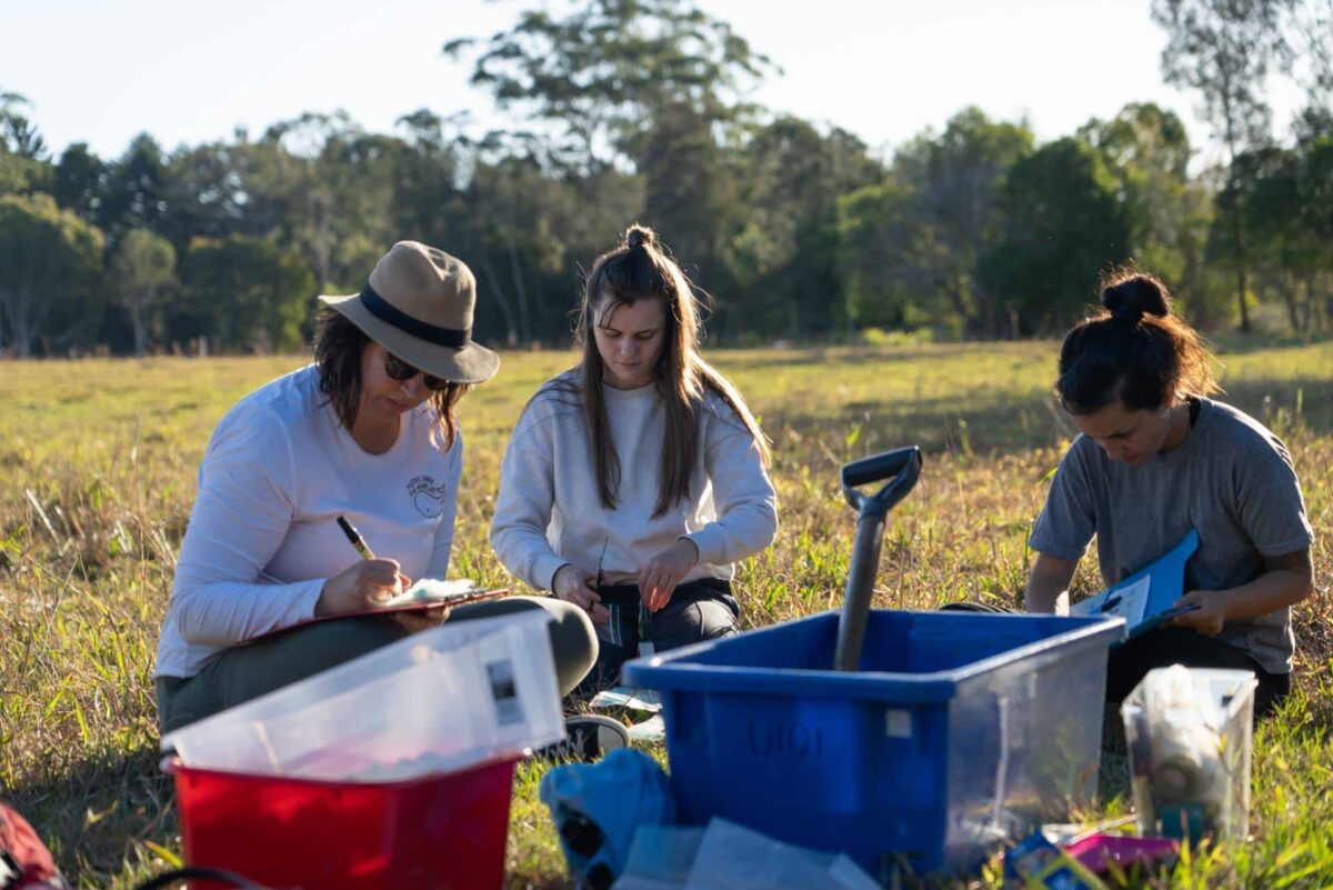
THE Brunswick River, BYRON SHIRE NSW
At the heart of the Byron Shire, the Brunswick River (affectionately known locally as ‘The Bruns’) lies at the southernmost boundary of the Nationally-important Burringbar to Conondale IBRA Subregion – one of the most biodiverse Subregions in Australia’s Strategy for the National Reserve System 2009-2030.
Having worked on The Bruns for almost a decade, our team understand the dynamics needed both at an ecological, as well as a community level to ensure that this vital catchment is reinvigorated to ensure its long-term health.
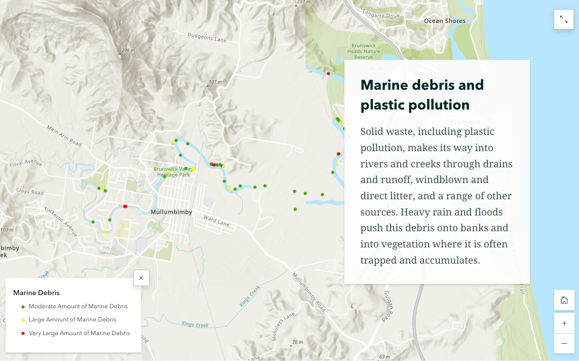
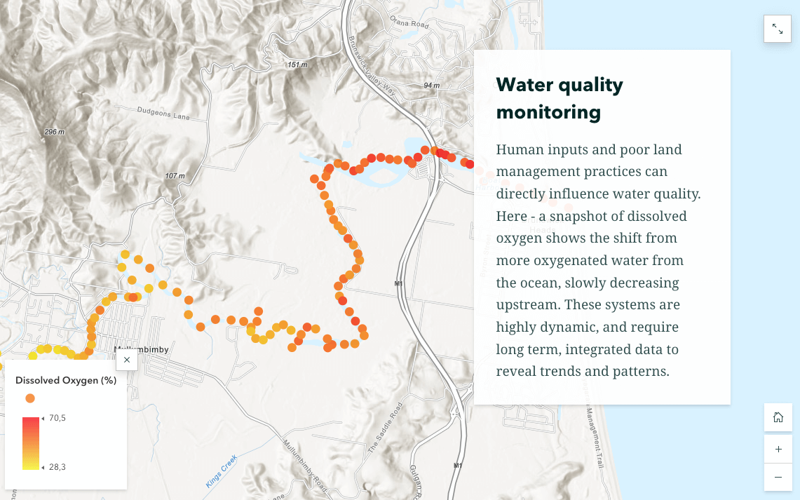
After over 12-months of on-ground research and community outreach, in 2021 we produced our innovative River Warriors ArcGIS StoryMap: an engaging online platform designed to display a wide range of ecological information in an interactive format, sharing the story of the key threats and solutions, to bring together a diverse group of stakeholders, including the management authorities responsible for ecosystem health across the catchment.
This platform also includes a unique data platform where users can contribute to our datasets through uploading their findings and pictures directly into the system itself.
Find out more about our innovative approach to catchment-wide resilience management, rewilding, community engagement, and how to contribute to our ongoing, adapative research through the StoryMap below.


Blue Forest Rewilding
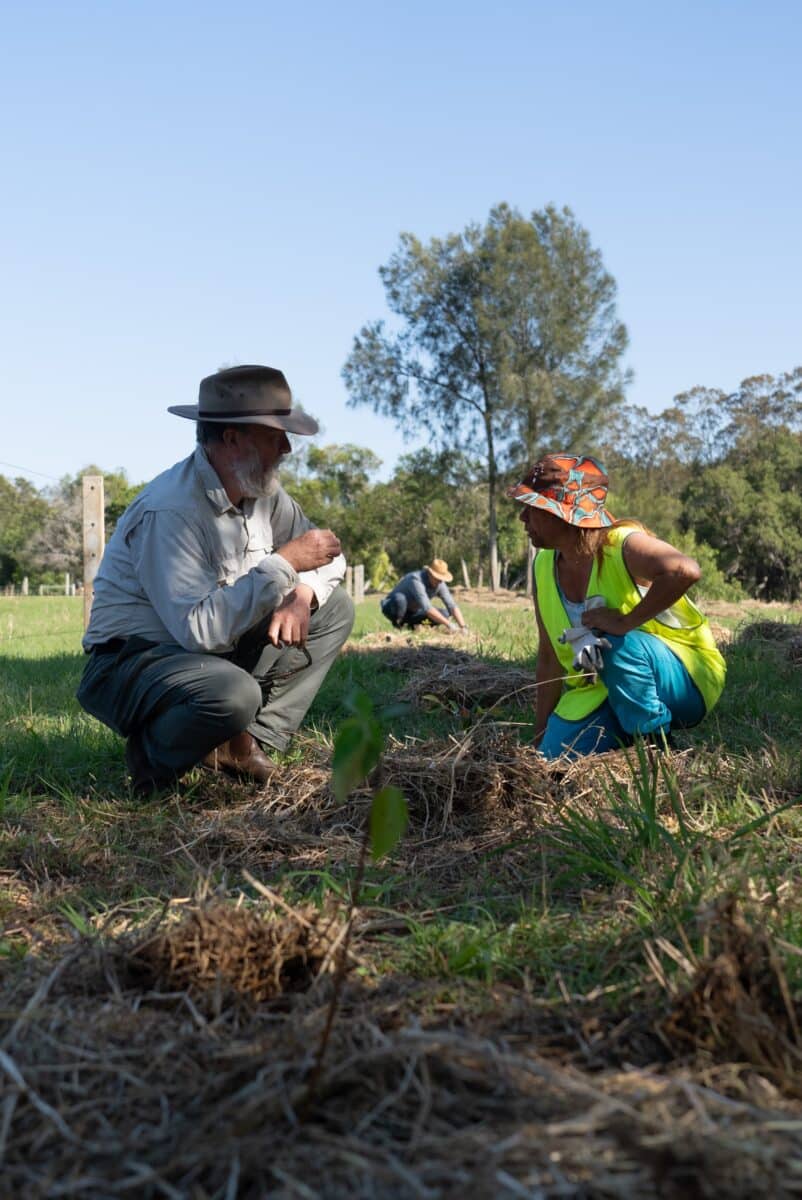
Alongside a broad range of local partners including landowners, fishers, Arakwal Traditional Owners, Southern Cross University (SCU), EarthWatch Australia, the NSW Department of Planning and Environment (DPE), Cape Byron Marine Parks, Byron Shire Council (BSC), and Brunswick Valley Landcare (BVL), we are leading blue and green forest mangrove rewilding programs, as well as developing plans for strategic catchment-wide corridors from source (Burringbar ranges) to sea (Cape Byron Marine Park) while monitoring wildlife with our partners at Wild BnB.
Utilising our data, networks and community-focused approach, we are aiming to relink the mountains to the sea, while strengthening biodiversity and estimating carbon sequestration rates to contribute to long-term climate resilience.
JOIN THE EVOLVING BRUNS RIVER COMMUNITY HUBMacro-invertebrate Water Quality Surveys & Monitoring
Supported by the NSW Department of Planning and Environment (DPE) post-flood water quality monitoring program funding in the region, we’re creating opportunities for the community to participate in citizen science activities designed to outline the importance of understanding, monitoring, and protecting this vital catchment.
The is generating scientifically robust data on the condition of intertidal and freshwater sections of the Brunswick River, giving a holistic overview of the condition of river health.
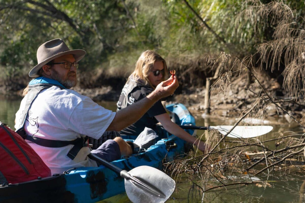
Aquatic macroinvertebrate citizen science surveys are an informative and fun way to engage community members to measure water quality using bioindicators. Macroinvertebrate diversity gives an indication of the condition (health) of a waterway and the types of stressors that might be having a negative impact. Macroinvertebrate surveys are also useful for monitoring long-term water quality patterns.
Data collection protocols follow standardised methodology and analysis, and will be completed with assistance from experts from our partners at Southern Cross University (SCU) and James Cook University (JCU).
VIEW ROUND 1 WATER QUALITY DATA HERE
Healthy Rivers Citizen Science Program
We’re working with Mangrove Watch (EarthWatch Australia) and Southern Cross University (SCU) to enhance our growing citizen science monitoring program. The program monitors mangroves, saltmarsh, seagrass beds, the condition of riparian vegetation, presence of invasive species, riverbank erosion, and debris hotspots (contributing ongoing data to our Brunswick River StoryMap), with boat support supplied by Marine Rescue Brunswick.
We also collect water quality abiotic readings periodically during surveys, ensuring that samples are taken across the estuary. Engaging people in mangrove citizen science improves local awareness of tidal wetland habitat values and threats, helps to fill scientific knowledge gaps, and informs wetland management strategies.
These outcomes improve estuary conservation, contributing to wider catchment health outcomes such as improved water quality, increased habitat, and greater climate resilience.
BECOME A CITIZEN SCIENTIST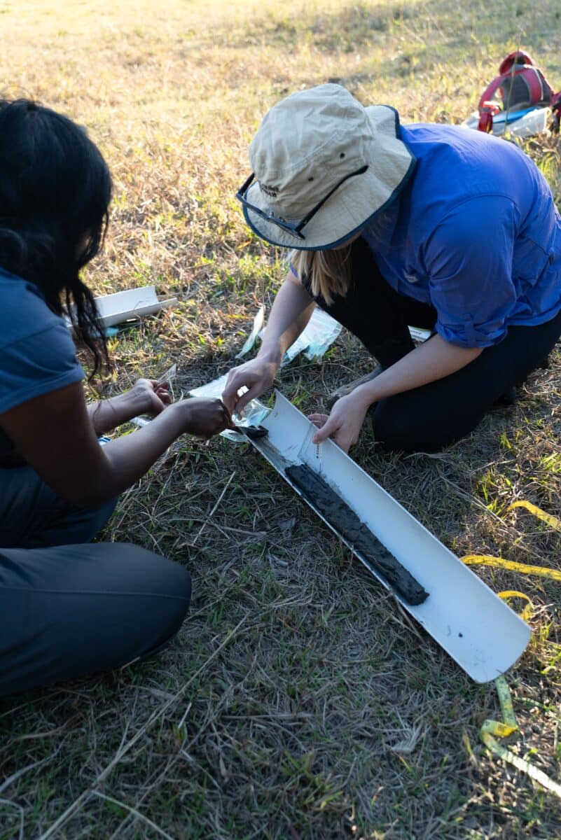
The Ubuntu Foundation proudly support Rewilding our Floodplains Global.
The Healthy Rivers and Wild Wetlands projects are being delivered through the NSW Environment Protection Authority’s Flood Recovery Program for Water Quality Monitoring, in partnership with the NSW Department of Climate Change, Energy, the Environment and Water, and supported by the Riparian Stabilisation Package. The Riparian Stabilisation Package is co-funded by the Australian and NSW Governments under Disaster Recovery Funding Arrangements.


Our global programs need your support, help us make positive change for people and planet.
All donations are tax deductible!


